Selection of Projects
A selection of projects and brief descriptions of work we have performed. This list is not exhaustive and is continually updated as we perform more work. Geophyscial applications are varied and each project is unique. We have found that often a simple conversation illuminates numerous options for geophyscial investigation and allows for rapid understanding of the scope of the project. Please CONTACT US to see if Geophysical Exploration can help with your project.
Magnetotelluric surveys
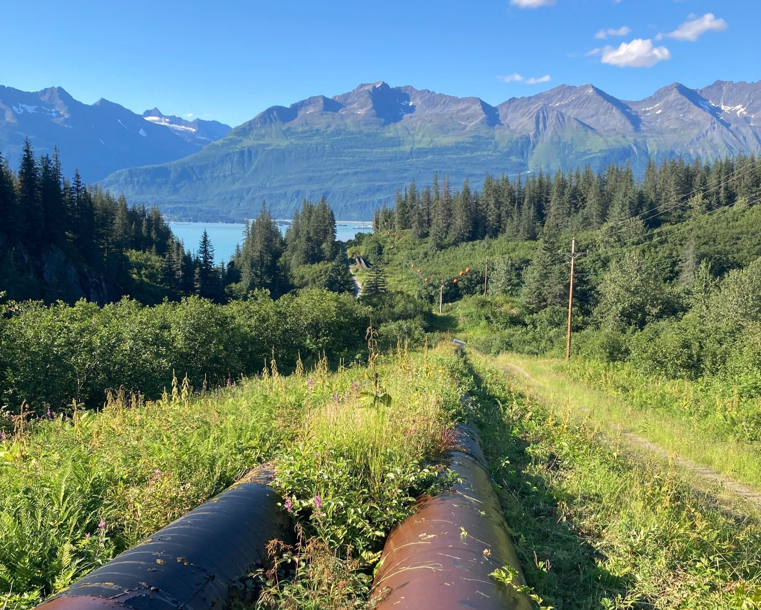
We acquired audio-band magnetotelluric data in an extremely remote and logistically difficult area. Operations included building a multi-week camp for four individuals, hiring and working with a helicopter, and collecting data in a volatile maritime environment that routinely receives intense storms. We safely completed surveys on time and on budget. Following collection, we processed and interpreted data into a three-dimensional model of the resistivity structure of an area that encompasses more than 4.5 square miles.
We were performing surveys to identify possible geothermal plays and were the initial exploration of any kind for this project. We had no a priori information on the terrain nor site conditions. While initial explorations don’t always yield interesting results, we were happy to provide our client with three-dimensional models that look extremely promising. This method is powerful in that we are able to relatively quickly gather information on the resistivity structure to depths of 5000 to 6000 feet.
Magnetotelluric work has been effective for subsurface exploration in geothermal, mining, and oil and gas exploration. This type of survey also is commonly used to investigate geologic structure, and is especially powerful for corroborating and investigating gravity and magnetic work. As with most geophysical exploration, multiple techniques tend to yield better and more accurate results.
EM-61 metal detection surveys
Acquired EM-61 data over a large area to help delineate the edges of a buried waste area and specifically identify target zones with possible buried drums or other metal objects of concern for environmental monitoring efforts. This method is very sensitive to metal objects down to depths of 8-10 feet. If ground conductivity information is not important, and metal targets are the goal, metal detectors are ideal in that large areas can be investigated quickly in comparison to conductivity methods. Where conductivity information is important and the need for understanding of vertical and lateral contrasts in conductivity or deeper information is needed- such as for geological structure, groundwater applications, mineral exploration, or deeper site investigations for metal- conductivity methods are required.
Multi-channel Analysis of Surface waves
This area had known very shallow bedrock with high velocity contrasts making deep seismic refraction impossible. Our client needed an understanding of potential large voids and lava tubes at depth in the subsurface and bedrock depth in order to locate a large building complex. We performed MASW seismic surveys to map depth to bedrock/bedrock topography and investigate for any potential voids. This project consisted of perpendicular line collection to test multiple locations for suitability. Fortunately, no voids were located, but areas with far larger bedrock topography than expected were identified, which helped rule out a number of potential locations, saving the client many wasted boreholes. Seismic methods excel at identifying bedrock in the subsurface and after many miles of bedrock depth searching around the country, these methods continue to deliver!
GPR Surveys in crawl space
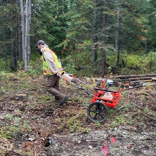
Acquired GPR in a crawl space to identify the extent of voids beneath slabs of concrete. We completed large surveys and mapped nearly 10,000 square feet of slab throughout a large complex that was subsiding. Engineers needed to know the extent of voids below the slabs to begin addressing the problem. We successfully identified voids and helped direct slab cuts into effected areas whilst avoiding numerous cuts into unaffected areas. These surveys were in restricted areas and required high levels of coordination with clients and site personnel.
Concrete Parking garage gpr
Performed GPR surveys in a multi-level concrete parking garage to isolate post tension cables and rebar. These surveys needed to occur on the ceiling and floor of multiple levels to address water infiltration that resulted in slab compromise. This job occurred sporadically over 4 weeks to accommodate the schedule of our client. We also needed to add multiple surveys in areas identified after work began as the concrete was highly impacted by water infiltration and we needed to be flexible to address newly found areas of concern. GPR proved effective at locating our desired targets of rebar and post tension cables, even with the severely degraded nature of the concrete.
VS100 (commonly known as vs30)
Performed Vertical Seismic Profiling surveys in the top 100 feet of boreholes on a project to help tie MASW profiles previously collected to borehole locations and provide valuable information for the engineering team. This technique is commonly known as VS30 in the literature, but in this case instead of the top 30 feet being profiled, we collected down to 100 feet.
Cemetary GPR survey
Performed GPR surveys to help clarify occupied or unoccupied gravesites. Surveys included nearly 10 acres of land, and required Real Time Kinetic (RTK) global positioning for accuracies within centimeters. In order to accomplish RTK quality data in this location, we needed to collect static GNSS data and post process in order to create a local base station for RTK capabilities.
Concrete Scanning for utilty location
Performed high resolution GPR surveys to identify rebar and utilities for drilling operations during building stabilization project. This multi-phased project required more than 20,000 square feet of concrete to be scanned, processed, and interpreted in a timely manner and within strict timelines for the client to remain on schedule.
Image shows a cross hatch pattern of rebar with diagonal utilities.
Multi-channel Analysis of Surface Waves
Performed MASW analysis to provide seismic stability information necessary for building design. This project required flexibility of scheduling due to site work, and we were able to make the survey happen while coordinating with onsite drilling operations.
Ground Penetrating Radar and utility location
Performed GPR and utility location for a client that needed an area cleared for borehole location through asphalt.
Seismic Refraction Tomography and Multi-channel Analysis of Surface waves
Performed Seismic Refraction Tomography and Multi-Channel Analysis of Surface Waves to give valuable slope stability and bedrock topography information to a client in Alaska. This site involved harsh conditions from meteorological and data collection perspectives. Despite cold and wet weather, difficult ground conditions, and large machinery operations on site, we successfully completed our surveys in a timely and happy manner!
Electrical Surveys- minerals
Worked in remote northwestern Alaska to collect Direct Current Resistivity and Induced Polarization data with the goal of exploring for mineralized ore bearing skarn deposits. We worked in difficult conditions and terrain to bring valuable information to our client within budget and timeline.
Magnetic Data collection
Collected more than 30 miles of magnetic data across properties with various landownership in western Montana. The purpose of the surveys were to explore geologic structure in the area. Data were processed, modeled, inverted, and interpreted which lead to the discovery of numerous unidentified geologic structures in the area.
Ground penetrating radar
Mapped utility and sprinkler pipe locations in a common area located on the University of Montana.
Integrated interpretation- Seismic, Magnetic, Gravity methods
Collected, processed, and interpreted hammer and vibroseis source seismic, gravity, and magnetic data in Oregon to explore subsurface geology and structure.
Geologic Electrical Surveys
Worked to identify geologic structure in a complex volcanic landscape. We collected, processed, and interpreted Direct Current Electrical Current Resistivity to determine subsurface resistivity in the shallow subsurface for drilling purposes.
magnetotelluric exploration
Worked at Neal Hot Springs in Oregon to determine deep resistivity structure. We collected, processed, and interpreted Controlled Source Audio-frequency Magnetotelluric data to identify subsurface structure and geothermal alteration related to the large geothermal system.


Gravity modeling
Used borehole lithologic information combined with gravimetric data to produce models of the subsurface and gain insight into lateral extent and depth of lithologies and geologic structures for exploration purposes.
Marine Seismic Processing
Processed and interpreted marine seismic data in offshore western Alaska to explore subsurface conditions for derrick location. Produced time migrated seismic lines over several kilometers of line.
Malaysian Airlines Flight 370
Collected Multi-beam Bathymetry and Synthetic-Aperture Side-Scan Sonar in a multi-year attempt at locating the missing Malaysian Airlines Flight MH370. Spent months in the southern Indian Ocean in a variety of conditions including significant wave heights greater than 9 meters.


